
If you found this website useful, feel free to click here to buy us a coffee! 😄
THIS IS A WORK IN PROGRESS!
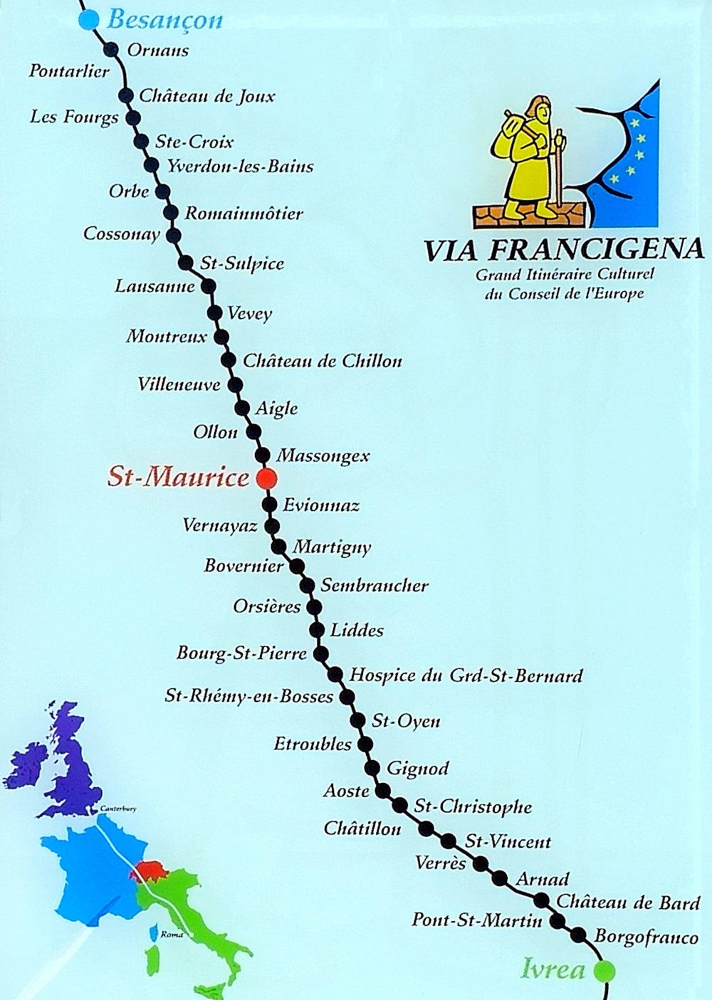
We started of from home on 15th April 2025, taking the train to Pontalier, and returning to walk consecutive sections of the way.
Then in October 2025 we started in Martigny and walked over the Great Saint Bernard pass to Aosta.
GRAND TOTALS:
24 walking days between 15/04/2025 and 11/04/2026
Total distance 327 km (approx. 13.6 km/day)
5497 m of ascent
and
6242 m of descent
in total
| Date |  F R A N C E F R A N C E
|
Page | Maps | GPX | km | m up | m dn |
|---|---|---|---|---|---|---|---|
| 15/04/2025 | Pontarlier to La Cluse et Mijoux | Link | Map | GPX | 9.0 | 234 | 204 |
| 09/05/2025 | La Cluse to Les Fourgs | Link | Map | GPX | 6.2 | 235 | 21 |
| Date |  S W I T Z E R L A N D S W I T Z E R L A N D
|
Page | Maps | GPX | km | m up | m dn |
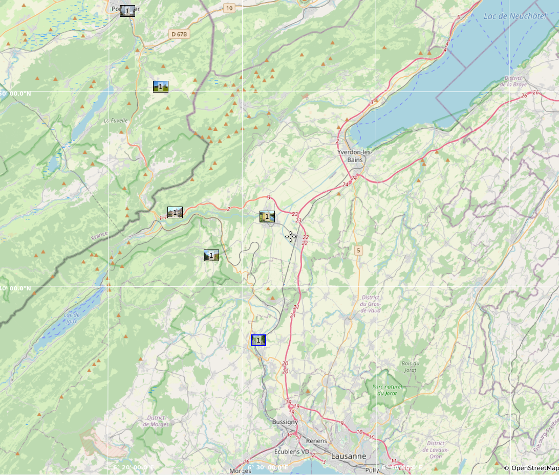
| 10/05/2025 | Les Fourgs (F) to Ballaigues (CH) | Link | Map | GPX | 22.0 | 302 | 518 |
| 15/05/2025 | Ballaigues to Orbe | Link | Map | GPX | 15.8 | 145 | 537 |
| 23/05/2025 | Orbe to Romainmôtier | Link | Map | GPX | 13.7 | 325 | 150 |
| 23/05/2025 | Romainmôtier to Croy | Link | Map | GPX | 1.8 | 8 | 28 |
| 24/05/2025 | Croy to Cossonay-Penthalaz | Link | Map | GPX | 17.2 | 34 | 247 |
| 09/06/2025 | Cossonay-Penthalaz to Bussigny | Link | Map | GPX | 10.6 | 107 | 128 |
| 20/06/2025 | Bussigny to St.Sulpice | Link | Map | GPX | 10.0 | 10 | 43 |
| 30/07/2025 | Lausanne-Ouchy to Vevey | Link | Map | GPX | 21.9 | 186 | 171 |
| 06/08/2025 | Vevey via Villeneuve to Yvorne | Link | Map | GPX | 10.7 | 39 | 0 |
| 07/08/2025 | Yvorne to Monthey | Link | Map | GPX | 13.1 | 67 | 80 |
| 08/08/2025 | Monthey to St.Maurice | Link | Map | GPX | 11.4 | 76 | 69 |
| 21/09/2025 | St.Maurice to Martigny | Link | Map | GPX | 17.9 | 147 | 95 |
| 06/10/2025 | Martigny to Sembracher | Link | Map | GPX | 13.6 | 348 | 136- |
| 07/10/2025 | Orsières to Bourg-St-Pierre | Link | Map | GPX | 15.8 | 853 | 124 |
| 08/10/2025 | Bourg-St-Pierre to Grand St.Bernard | Link | Map | GPX | 12.5 | 969 | 143 |
 I T A L Y I T A L Y
|
|||||||
| Date | |
Page | Maps | GPX | km | m up | m dn |
| 09/10/2025 | Grand-St-Bernard to St.Leonard | Link | Map | GPX | 9.8 | 13 | 952 |
| 10/10/2025 | St.Leonard to Gignod | Link | Map | GPX | 16.8 | 47 | 652 |
| 11/10/2025 | Gignod to Aosta | Link | Map | GPX | 6.7 | 4 | 344 |
| 07/04/2026 | Aosta to Nus | Link | Map | GPX | 15.7 | 317 | 360 |
| 08/04/2026 | Nus to Châtillon | Link | Map | GPX | 15.4 | 364 | 366 |
| 09/04/2026 | Châtillon to Muret (Monjovet) | Link | Map | GPX | 14 | 295 | 428 |
| 10/04/2026 | Monjovet to Arnad | Link | Map | GPX | 12.8 | 249 | 317 |
| 11/04/2026 | Arnad to Pont St.Martin | Link | Map | GPX | 12.5 | 123 | 129 |
| Date |  P i e m o n t e P i e m o n t e
|
Page | Maps | GPX | km | m up | m dn |
| Date | P L A N N E D
|
Page | Maps | GPX | km | m up | m dn |
| Planned | Pont St.Martin to Ivrea | Link | Map | GPX | ˜22 | ˜300 | ˜400 |
| Planned | Ivrea to Viverone | Link | Map | GPX | ˜20 | ˜400 | ˜360 |
| Planned | Viverone to Santhia | Link | Map | GPX | ˜17 | ˜150 | ˜270 |
| Planned | Viverone to Cascine Stra ??? | Link | Map | GPX | ˜18km?? | ˜ | ˜ |
| Planned | Cascine Stra ??? to Vercelli | Link | Map | GPX | ˜10 | ˜ | ˜ |
| Planned | ... | Link | Map | GPX | ˜ | ˜ | ˜ |